Sequim School District's Science Fair Club
Photometry measurements of light intensity and temperatures will be used to develop models to select sites suitable for eelgrass restoration in and around the Strait of Juan de Fuca.
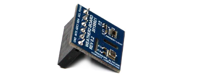
Debra Becket, a teacher participant in the Olympic STEM Pathways Partnership program, submitted this story about her work with the Sequim School District’s Science Fair Club. The club is developing a Science Fair Project based on the SeaState Odroid and Weather Board technology. This project was developed to make photometry measurements of light intensity and temperatures at the surface of marine waters and at shallow underwater depths. The data will be used to develop models to select sites suitable for eelgrass restoration in and around the Strait of Juan de Fuca. The project involves the design and deployment of a standalone buoy and a tethered buoy that is tied to shore power and communications for data collection. The standalone buoy system has photovoltaics and batteries for power and a broadband/Wi-Fi router for communication onboard. The tethered buoy system plugs into an existing power and router for communications. Both systems require periodic maintenance and downloading of stored data.
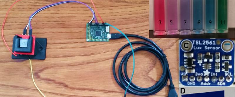
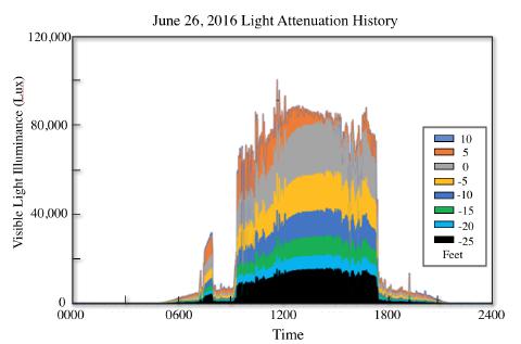
Two data collection sites have been identified over existing eelgrass beds on the Strait of Juan de Fuca. Data collected at both sites include date, time, total light intensity, infrared light intensity and temperature at intervals of 1-6 minutes. Over a two day period in June 2016, the technology was bench tested outside using the technology as a proof of concept. The installation measured total visible light intensity at the surface, and simulated at depth, using a mesh fabric over the lower sensor (Figure 1 in slide show).
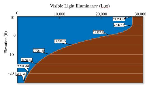
The attenuation of the collected data was then analyzed using an average linear attenuation coefficient from the simulated data in an exponential decay model. Most of the day was sunny except for several clouds that blocked the sun in the morning and late afternoon. Fluctuations in water height were included over the time period from water level measurements by NOAA at Port Townsend, WA (Figure 2). The simulated total light exposure was developed by adding up each data point as a form of numerical integration over the day. The result is presented in the graph below as total exposure of light as a function of elevation.
The attenuation of the collected data was then analyzed using an average linear attenuation coefficient from the simulated data in an exponential decay model. For the most part the day was sunny during this day, except for several clouds that blocked the sun in the morning and late afternoon. Fluctuations in water height were included over the time period from water level measurements by NOAA at Port Townsend, WA. The simulated total light exposure was developed by adding up each data point as a form of numerical integration over the day and ipresented as total exposure of light as a function of elevation (Figure 3 in slide show).
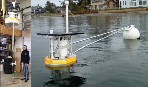
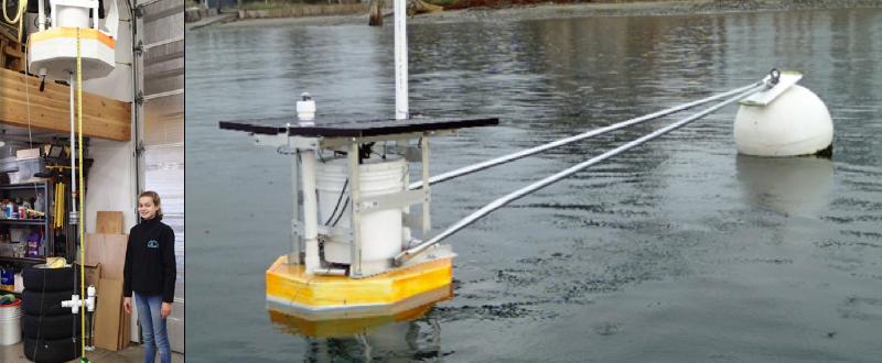
A student built the standalone buoy in her home garage that included solar panels. The initial deployment of the buoy was in the Strait of Juan de Fuca. The buoy installation failed in November during storms because of last minute changes to its anchorage system. The student then redesigned the stand alone buoy to add a brace for stability and designed and constructed the shore tethered buoy.
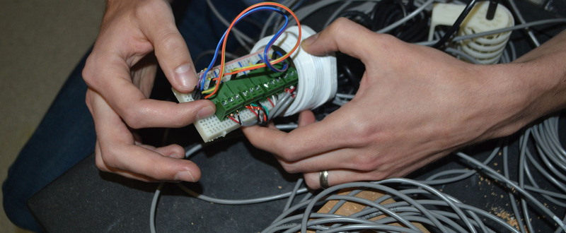
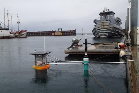
The shore tethered buoy was planned to have approximately 100 m of electrical conduit between the buoy/sensors offshore and data logger on land. During bench testing, it was discovered that the planned distance between buoy/sensors and the data logger was too long for the data transmission protocol between the Weatherboard sensors and the Odroid data logger. Additional bench testing with increasingly shorter electrical conduit was successful at approximately 10 m and calibration trials of the two buoys side by side was conducted in March (Figure 4).
This high school student and her project was awarded first place in its category at the Washington State Science and Engineering Fair at the beginning of April. The tethered buoy is currently being redesigned and constructed with onboard power and communication systems similar to the stand-alone buoy except it will be anchored independently to the sea floor rather than on a mooring buoy. Both buoys will be deployed this summer to monitor light and temperature effects on eelgrass meadows over time at two different sites along the Strait of Juan de Fuca.
Photometry measurements of light intensity and temperatures will be used to develop models to select sites suitable for eelgrass restoration in and around the Strait of Juan de Fuca.
Image Gallery